Neighborhood correction technique for Coupling effects of multi-beam bathymetry
-
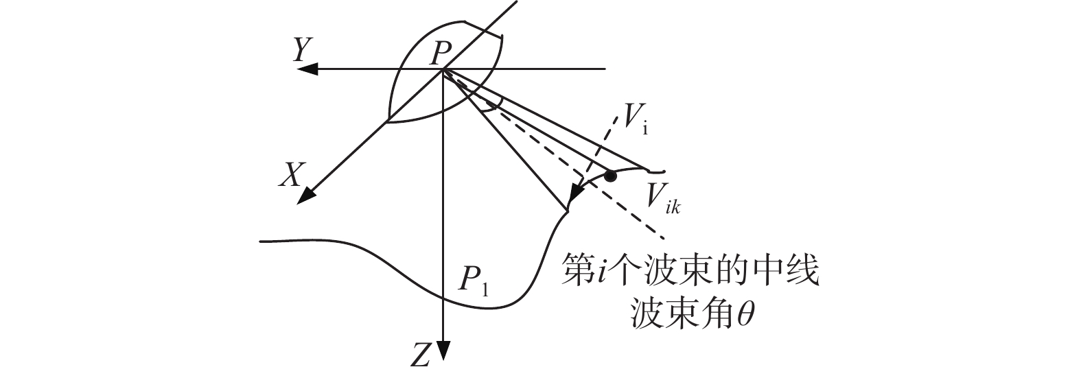
摘要: 针对多波束声纳测深系统中波束角效应和地形效应对水深测量的影响,提出了一种基于地形平均坡度水深数据改正的方法,以解决不同地势情况下造成的水深数据失真问题. 首先根据多波束系统的测量原理建立了水深测量模型,与测量点周围8个点之间平均坡度估计该点处地形倾斜角,通过测量水深与海底地形之间的关系进行不同程度的水深改正,以获得测深处的真实水深. 仿真过程中通过计算测点周围邻域8个方向的平均坡度,对地形平均坡度进行估计,并用实际某海域地形进行检验. 结果标明:该技术应用性强,对水深测量中波束角与地形效应的影响具有明显的改正效果.Abstract: Aiming at the influence of angular beam-width and terrain effect on bathymetry in multi-beam sonar system. A correction method of depth survey based on average slope of terrain is proposed to solve the problem of water depth data distortion caused by different terrain conditions. Firstly, a depth measurement model was established based on the principle of multi-beam system. The average slope between the measurement point and 8 points around was used to estimate the inclination angle of the terrain at that point. Different degrees of water depth correction were made by the relationship between depth measured and seabed to obtain the real depth at the survey point. During the simulation process, the average slope of the terrain is estimated by calculating the average slope in eight directions around the survey point. The method is verified with actual terrain. Results show that it is highly practical and has significant correction effects on the impact of beam angle and terrain effects in bathymetric survey.
-
表 1 改正前后误差对比
误差 平均误差/m 最大误差/m 经度范围/(°) 改正前 2.58 4.89 125.128 1~125.128 5 改正后 0.86 1.39 125.128 1~125.128 5 -
[1] 吴英姿, 徐新盛, 乔力争. 多波束测深系统的精度评估方法研究[J]. 海洋技术, 2003, 22(3): 65-69. [2] 黄谟涛, 翟国君, 欧阳永忠, 等. 海洋测量误差处理技术研究[J]. 海洋测绘, 2003, 23(3): 57-62. [3] 李海森, 周天, 徐超. 多波束测深声纳技术研究新进展[J]. 声学技术, 2013, 32(2): 73-80. [4] 赵建虎, 欧阳永忠, 王爱学. 海底地形测量技术现状及发展趋势[J]. 测绘学报, 2017, 46(10): 1786-1794. [5] 史红礼, 王池. 水下地形测量的影响因素及解决方法[J]. 四川水力发电. 2018, 37(3): 85-147. [6] YANG J, JACKSON D. Measurement of sound speed in fine-grained sediments during the seabed characterization experiment[J]. IEEE journal of oceanic engineering, 2020, 45(1): 39-50. DOI: 10.1109/JOE.2019.2946004 [7] 崔晓东, 简波, 李富强, 等. 单波束测深波束角效应的自动改正方法[J]. 山东科技大学学报(自然科学版), 2017, 36(1): 29-37. [8] CHEN Y Q, LIU Y C. Corrections for the seabed distortions caused by the angular beam width of echo sounders[J]. The hydrographic journel, 1997, 84(4): 15-19. [9] 于家城, 宋春雷, 徐学强, 等. 海洋测深综合效应的多测线改正技术[J]. 海洋测绘, 2008, 28(2): 9-16. DOI: 10.3969/j.issn.1671-3044.2008.02.003 [10] 刘雁春, 陈永奇. 海洋测深的波束角效应及其改正[J]. 海洋测绘, 1999(2): 20-27. [11] OKINO M, HIGASHI Y. Measurement of seabed topography by multibeam sonar using CFFT[J]. IEEE journal of oceanic engineering, 1986, 11(4): 474-479. DOI: 10.1109/JOE.1986.1145209 [12] 于家成, 徐学强. 基于地形平均斜率的多波束数字水深处理[J]. 系统仿真学报, 2015, 27(5): 990-996. [13] 于家城, 宋春雷, 晏磊, 等. 多波束声纳数字测深与改正模型[J]. 北京大学学报(自然科学版), 2008, 44(3): 429-433. [14] 赵建虎. 多波束测深及图像数据处理[M]. 武汉: 武汉大学出版社, 2008: 60. [15] 蔚保国, 尹继凯, 郝青茹. 杨元喜, 编. 卫星导航数字多波束测量系统[M]. 北京: 国防工业出版社, 2021: 80. -


 下载:
下载:


